News / National
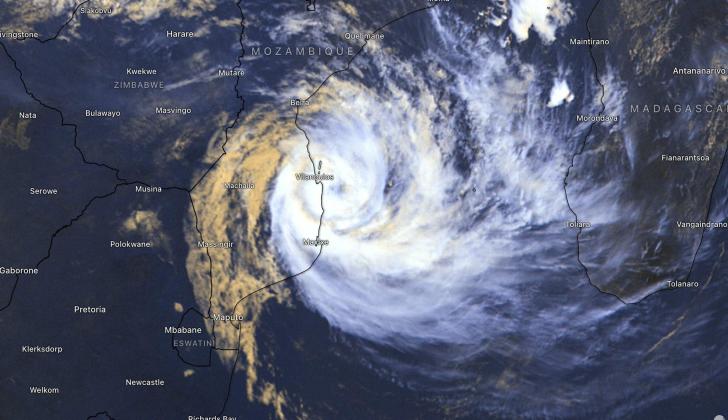
Cyclone Bheki forms over Indian Ocean, Southern Africa braces for potential impact
18 Nov 2024 at 15:04hrs |
0 Views

The Meteorological Services Department (MSD) has announced the formation of Cyclone Bheki, the second tropical storm of the season, over the Indian Ocean. While the storm is still far from Zimbabwe and poses no immediate threat, authorities are closely monitoring its development to provide timely updates.
"At this time, it is still too distant to raise any concerns," the MSD noted in its weather bulletin released on Sunday morning.
Current Weather Conditions
Southern Zimbabwe has already experienced thunderstorms and sporadic rainfall. On Saturday, Harare's Belvedere area recorded the highest rainfall at 34mm, followed by Nkayi with 20mm and Tsholotsho at 7mm.
The MSD predicts mild to warm conditions across the country for Monday and Tuesday, with isolated thunderstorms expected north of the watershed. In contrast, southern regions, including Matabeleland South and Masvingo, are forecasted to have warmer, sunnier days but should brace for potential evening showers.
Precautionary Measures
In light of ongoing rains and the potential for extreme weather, the MSD has issued safety recommendations:
Seek shelter during thunderstorms: "When thunder roars, it is best to be indoors."
Secure property: Rooftops, particularly in schools, should be reinforced as strong winds and hail may accompany the rains in some areas.
Communities on Alert
Residents in southern Zimbabwe, particularly in areas near Tsholotsho and Masvingo, are advised to remain vigilant. The presence of Cyclone Bheki serves as a reminder of the storm season's unpredictability and the importance of being prepared for potential weather emergencies.
Authorities have urged the public to stay informed by following updates from official channels as more information about Cyclone Bheki's trajectory and impact becomes available.
Source - The Herald
Join the discussion
Loading comments…


